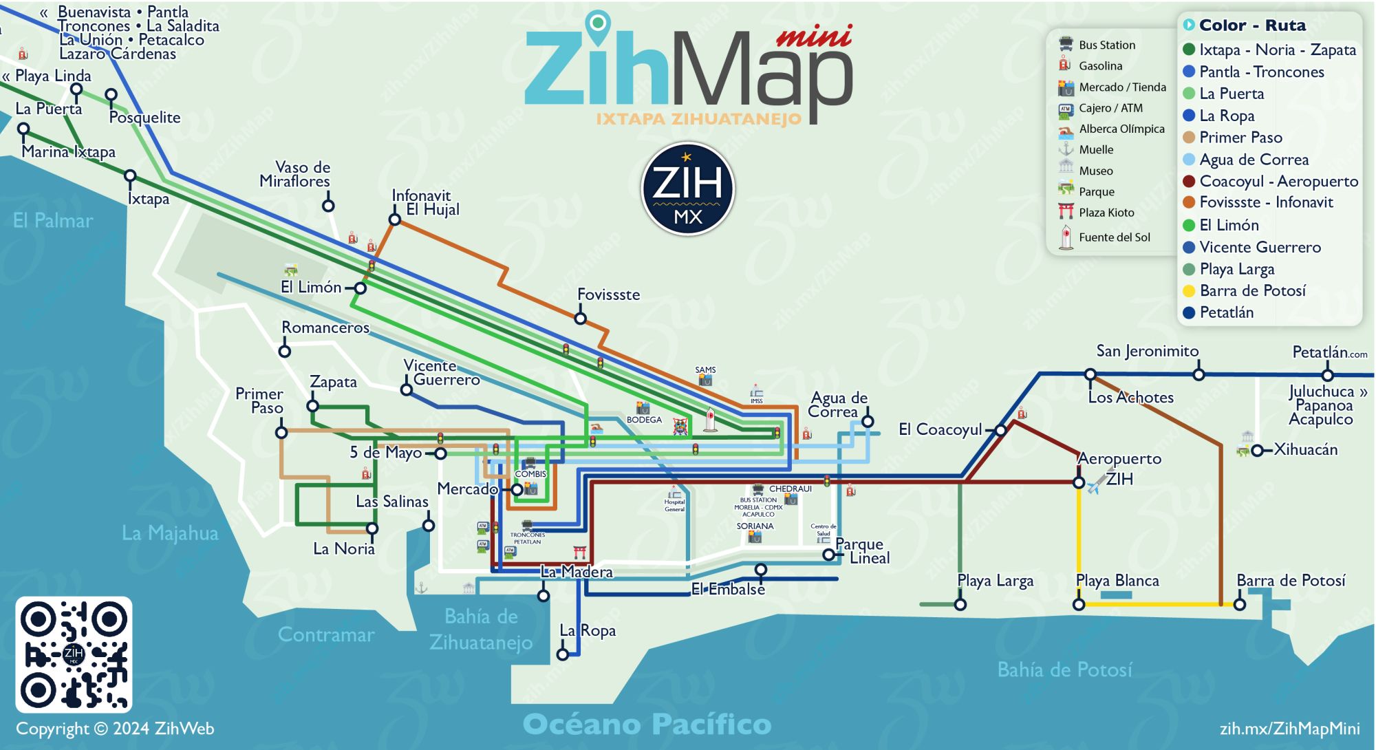
🗺 ZihMap mini v.0.6.2025

This map resembles a very minimalist version of the Ixtapa & Zihuatanejo Bay from Marina Ixtapa to Barra de Potosí, each line represent the color on the side of the buses or vans called combis by locals and the route they follow trough some colonies and reference spots in the city.
- ⛽ Gas station zih.mx/d/c/279
- 🏧 ATM/Banks zih.mx/d/c/44
- 🚦Traffic light
- ⚓ Pier of Zihuatanejo bay
- 🏛 Museum MACOGRA zih.mx/d/2q
- 🚍 Bus Station (to Acapulco, Morelia, CDMX)
- 🛍 Store (Mercado, Bodega, Soriana, Sams)
- 🏥 Hospital (Hospital General, IMSS)
- 🏞 Park (Xihuacan, El Limón)
- 🏊 Olympic Pool / Sports Complex
🔗 Links